| Avon | |
|---|---|
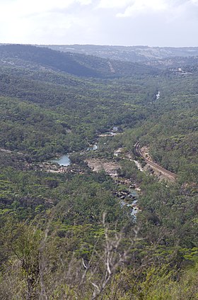
 Avon River flowing through the Avon Valley National Park | |
 Location of the Avon River and its catchment area | |
| Location | |
| Country | Australia |
| State | Western Australia |
| Region | Wheatbelt |
| Physical characteristics | |
| Source | surface runoff |
| • location | East of Pingelly |
| • coordinates | 32°44′52″S 117°28′0″E / 32.74778°S 117.46667°E |
| • elevation | 269 m (883 ft) |
| Mouth | confluence with Wooroloo Brook to form the Swan River |
• location | below Mount Mambup |
• coordinates | 31°44′34″S 116°4′4″E / 31.74278°S 116.06778°E |
• elevation | 29 m (95 ft) |
| Length | 240 km (150 mi) |
| Basin size | 125,000 km2 (48,000 sq mi) |
| Discharge | |
| • location | mouth |
| • average | 10 m3/s (350 cu ft/s) |
| Basin features | |
| River system | Swan River |
| Tributaries | |
| • left | Dale River |
| • right | Mackie River, Mortlock River, Brockman River |
| National park | Avon Valley National Park |
The Avon River is a river in Western Australia. A tributary of the Swan River, the Avon flows 240 kilometres (150 mi)[1] from source to mouth, with a catchment area of 125,000 square kilometres (48,000 sq mi).[2]
- ^ Cite error: The named reference
bonzlewas invoked but never defined (see the help page). - ^ "The Swan-Avon Catchments". Describing the Swan River. State Library of Western Australia. 23 November 2010.