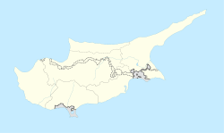
Ayioi Omoloyites
Άγιοι Ομολογητές | |
|---|---|
 Ayioi Omoloyites Avenue, traditional thoroughfare of the old village. Note the narrowness of the street and traditional design of the houses | |
| Coordinates: 35°9′39″N 33°21′6″E / 35.16083°N 33.35167°E | |
| Country | |
| District | Nicosia District |
| Municipality | Nicosia |
| Population (2011)[1] | |
| • Total | 10,528 |
| Time zone | UTC+2 (EET) |
| • Summer (DST) | UTC+3 (EEST) |
Ayioi Omoloyites is a Neighbourhood, Quarter, Mahalla or Parish of Nicosia, Cyprus[2][3][4] and the parish church thereof. Its name in Greek is Άγιοι Ομολογητές, which means Holy Confessors (a group of saints defined by the church) and also has the name Ayii Omoloyitades (sometimes with "dh" instead of "d") used in older English language works and Turkish.
At the last Census (2011) it had a population of 10,528,[2] an increase from a population of 9,630 in 2001. It covers 153 streets in the south of the municipal area of Nicosia, including Ay. Omoloyiton Avenue, Kyriakou Matsi Avenue and parts of Griva Diyeni Avenue and Arch.Makarios III Avenue.[5]
- ^ Census 2011
- ^ a b "Population Enumerated by Sex, Age, District, Municipality/Community and Quarter, 2011 – (2011 Census of the Republic of Cyprus, Statistical Service)" (in Greek). Mof.gov.cy. Retrieved 21 July 2012.
- ^ Coexistence in the Disappeared Mixed Neighbourhoods of Nicosia by Ahmet An (Paper read at the conference: Nicosia: The Last Divided Capital in Europe, organized by the London Metropolitan University on 20 June 2011)
- ^ 6th edition of the publication "Statistical Codes of Municipalities, Communities and Quarters of Cyprus" (publ. Statistical Service of Republic of Cyprus)
- ^ Municipality/Community, Quarter and Street Index published by Ministry of Information (CILIS_streets_022011)
