Azalia, Michigan | |
|---|---|
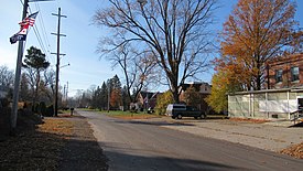
 Looking south along Dundee Azalia Road | |
| Coordinates: 42°01′08″N 83°39′57″W / 42.01889°N 83.66583°W | |
| Country | United States |
| State | Michigan |
| County | Monroe |
| Township | Milan |
| Elevation | 669 ft (204 m) |
| Time zone | UTC-5 (Eastern (EST)) |
| • Summer (DST) | UTC-4 (EDT) |
| ZIP code(s) | |
| Area code | 734 |
| FIPS code | 26-04680[1] |
| GNIS feature ID | 620397[2] |
Azalia is an unincorporated community in Monroe County in the U.S. state of Michigan.[2] The community is located within Milan Township. As an unincorporated community, Azalia has no legally defined boundaries or population statistics of its own but does have its own post office with the 48110 ZIP Code.[3][4]
- ^ "U.S. Census website". United States Census Bureau. Retrieved January 31, 2008.
- ^ a b U.S. Geological Survey Geographic Names Information System: Azalia, Michigan
- ^ UnitedStatesZipCodes.org (2021). "ZIP Code 48110: Azalia". Retrieved March 15, 2021.
- ^ "48110 ZIP Code map" (Map). Google Maps. Retrieved March 15, 2021.

