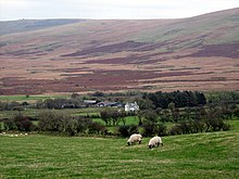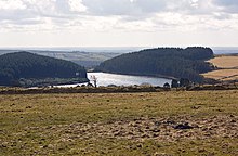


The B4329 is a scenic route and a former turnpike in Pembrokeshire, West Wales. It links Eglwyswrw in the north of the county to Haverfordwest, the county town in the south, in an approximately southwesterly direction, crossing the Preseli Mountains. It links to the A487 trunk road at both its northern and southern ends.
Before the 20th century, it was the main road linking Cardigan and Haverfordwest, and featured a number of inns to sustain travellers. The road is 19 miles (31 km) long and varies in elevation from 20–404 metres (66–1,325 ft) above sea level. Much of the route is through farmland with scattered settlements, while the central section is through high moorland grazing with extensive views.[1]
- ^ "Driving directions to Prendergast/B4329". Google Maps. Google Maps. Retrieved 27 July 2014.