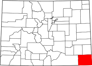
Baca County | |
|---|---|
 The Baca County Courthouse in Springfield. | |
 Location within the U.S. state of Colorado | |
 Colorado's location within the U.S. | |
| Coordinates: 37°19′N 102°34′W / 37.32°N 102.56°W | |
| Country | |
| State | |
| Founded | April 16, 1889 |
| Named for | Felipe Baca |
| Seat | Springfield |
| Largest town | Springfield |
| Area | |
• Total | 2,557 sq mi (6,620 km2) |
| • Land | 2,555 sq mi (6,620 km2) |
| • Water | 2.4 sq mi (6 km2) 0.09% |
| Population (2020) | |
• Total | 3,506[1] |
| • Density | 1.4/sq mi (0.5/km2) |
| Time zone | UTC−7 (Mountain) |
| • Summer (DST) | UTC−6 (MDT) |
| Congressional district | 4th |
| Website | bacacountyco |
Baca County is a county located in the U.S. state of Colorado. As of the 2020 census, the population was 3,506.[1] The county seat is Springfield.[2] Located at the southeast corner of Colorado, the county shares state borders with Kansas, New Mexico, and Oklahoma.
- ^ a b "U.S. Census Bureau QuickFacts". U.S. Census Bureau. Retrieved September 4, 2021.
- ^ "Find a County". National Association of Counties. Archived from the original on May 31, 2011. Retrieved June 7, 2011.