This article needs additional citations for verification. (October 2014) |
Badagry
Àgbádárìgì | |
|---|---|
Town | |
 A chair market at Badagry in 1910 | |
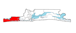
 Badagry shown within the State of Lagos | |
Coordinates: 6°25′N 2°53′E / 6.417°N 2.883°E
 | |
| Country | Nigeria |
| State | Lagos State |
| LGA | Badagry |
| Area | |
• Total | 170 sq mi (441 km2) |
| Population (2006) | |
• Total | 241,093 |
| Time zone | UTC+1 (WAT) |
| National language | Yorùbá, Gungbe |
| Website | www.badagrygov.org |
 | |
Badagry, also spelled Badagri,[1] (Gun: Gbagli) is a coastal town and Local Government Area (LGA) in Lagos State, Nigeria. It is quite close to the city of Lagos, and located on the north bank of Porto Novo Creek, an inland waterway that connects Lagos (Nigeria's largest city and economic capital) to the Beninese capital of Porto-Novo. The same route connects Lagos, Ilaro, and Porto-Novo, and shares a border with the Republic of Benin. As of the preliminary 2006 census results, the municipality had a population of 241,093.[2]
Serving as a lagoon and an Atlantic port, Badagry emerged as a commercial center on the West African coast between 1736 and 1851.[3] Its connecting and navigable lakes, creeks and inland lagoons acted as a means to facilitate trade and as a security bar for residents. During the Trans-Atlantic slave trade, the town was a middleman between European traders on the coast and traders from the hinterland.[4]
- ^ "Badagry | Nigeria". Encyclopedia Britannica. Retrieved 1 August 2021.
- ^ The area is led by a traditional king, Akran De Wheno Aholu Menu - Toyi 1, who is also the permanent vice-chairman of obas and chiefs in Lagos State. Federal Republic of Nigeria Official Gazette Archived 2007-07-04 at the Wayback Machine, published 15 May 2007, accessed 8 July 2007
- ^ Sorensen-Gilmour 1995, p. II, 3.
- ^ Sorensen-Gilmour 1995, p. 2-3.
