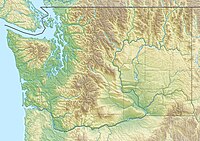
| Badger Mountain | |
|---|---|
 Badger Mountain from the Richland Wye. | |
| Highest point | |
| Elevation | 1,593 ft (486 m) NAVD 88[1] |
| Prominence | 915 ft (279 m)[1] |
| Isolation | 8.44 mi (13.58 km)[1] |
| Coordinates | 46°14′04″N 119°19′17″W / 46.234344°N 119.321525°W[1] |
| Geography | |
| Country | United States |
| State | Washington |
| County | Benton County |
| City | Richland |
| Parent range | Columbia River Plateau |
| Topo map | USGS Badger Mountain |
| Climbing | |
| Easiest route | Hike |
Badger Mountain is a small mountain in Richland, Washington. Badger rises above the Tri-Cities connected to the smaller Candy Mountain via Goose Gap, is visible throughout much of the area and is a popular hiking destination for a wide variety of climbers. There are a number of trails climbing the mountain with varying levels of difficulty. There are two summits on Badger Mountain, named the East Summit and the West Summit. The West Summit is the highest.
Most of Badger Mountain is protected by the Badger Mountain Centennial Preserve, but the radio towers at the peak are private property.[2] A non-profit group, Friends of Badger Mountain,[3] worked to procure this shrub-steppe area that has most native vegetation intact and then built a trail to the summit. The 1.2 miles (1.9 km) trail rises 984 feet (300 m) above the trail head in Richland.
- ^ a b c d "Badger Mountain, Washington". Peakbagger.com. Retrieved 31 May 2015.
- ^ "Trails & Directions". friendsofbadger.org. Retrieved 14 July 2015.
- ^ Friends of Badger Mountain
