Baghai | |
|---|---|
Village | |
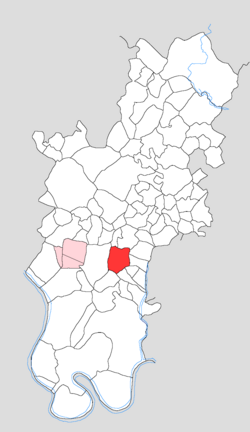
 Map showing Baghai in Tundla block | |
| Coordinates: 27°12′13″N 78°16′50″E / 27.20366°N 78.2805°E | |
| Country | India |
| State | Uttar Pradesh |
| District | Firozabad |
| Tehsil | Tundla |
| Area | |
| • Total | 3.888 km2 (1.501 sq mi) |
| Population (2011)[1] | |
| • Total | 2,483 |
| • Density | 640/km2 (1,700/sq mi) |
| Time zone | UTC+5:30 (IST) |
| PIN | 283103 |
Baghai (Bāghaī) is a village in Tundla block of Firozabad district, Uttar Pradesh, India. As of 2011, it had a population of 2,483, in 411 households.
