This article needs additional citations for verification. (November 2011) |
Bahnhofsviertel | |
|---|---|
| Coordinates: 50°06′06″N 08°39′34″E / 50.10167°N 8.65944°E | |
| Country | Germany |
| State | Hesse |
| Admin. region | Darmstadt |
| District | Urban district |
| City | Frankfurt am Main |
| Area | |
| • Total | 0.525 km2 (0.203 sq mi) |
| Population (2020-12-31)[1] | |
| • Total | 3,703 |
| • Density | 7,100/km2 (18,000/sq mi) |
| Time zone | UTC+01:00 (CET) |
| • Summer (DST) | UTC+02:00 (CEST) |
| Postal codes | 60329 |
| Dialling codes | 069 |
| Vehicle registration | F |
| Website | www.bahnhofsviertel.de |
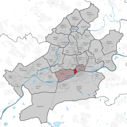
The Bahnhofsviertel (German pronunciation: [ˈbaːnhoːfsˌfɪʁtl̩]; literally: train station quarter) is a quarter of Frankfurt am Main, Germany. It is part of the Ortsbezirk Innenstadt I.
The Bahnhofsviertel was developed between 1891 and 1915. Along with the Westend, the Nordend and the Ostend, it is part of Frankfurt's dense inner city districts. The Bahnhofsviertel is known as one of Frankfurt's main entertainment and red-light districts (the latter esp. around Taunusstrasse), along with Alt-Sachsenhausen south of the river Main.[2]
- ^ "Frankfurt Statsitik Aktuell 07/2021". Stadt Frankfurt am Main. July 2021.
- ^ Nominato, Rozembergue (6 January 2017). "Bahnhofsviertel Frankfurt". MEININGER Hotels. Retrieved 29 December 2019.


