Baijiantan
白碱滩区 • جەرەنبۇلاق رايونى | |
|---|---|
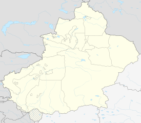
 Baijiantan in Karamay | |
| Coordinates: 45°38′N 85°11′E / 45.633°N 85.183°E | |
| Country | China |
| Autonomous region | Xinjiang |
| Prefecture-level city | Karamay |
| District seat | Zhongxing Road Subdistrict |
| Area | |
| • Total | 1,268 km2 (490 sq mi) |
| Population (2020)[1] | |
| • Total | 50,825 |
| • Density | 40/km2 (100/sq mi) |
| Time zone | UTC+8 (China Standard[a]) |
| Website | www |
| Baijiantan, Karamay | |||||||||||
|---|---|---|---|---|---|---|---|---|---|---|---|
| Chinese name | |||||||||||
| Simplified Chinese | 白碱滩区 | ||||||||||
| Traditional Chinese | 白鹼灘區 | ||||||||||
| |||||||||||
| Uyghur name | |||||||||||
| Uyghur | جەرەنبۇلاق رايونى | ||||||||||
| |||||||||||
Baijiantan District (Chinese: 白碱滩区; Uyghur: جەرەنبۇلاق رايونى) is a district of the city of Karamay in the Xinjiang Uyghur Autonomous Region. It contains an area of 1,272 km2 (491 sq mi). According to the 2002 census, it has a population of 60,000.
Cite error: There are <ref group=lower-alpha> tags or {{efn}} templates on this page, but the references will not show without a {{reflist|group=lower-alpha}} template or {{notelist}} template (see the help page).


