Bajaur District
ضلع باجوڑ باجوړ ولسوالۍ | |
|---|---|
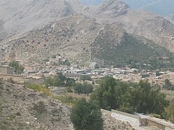
View of Bajaur Bottom: View of Guluna | |
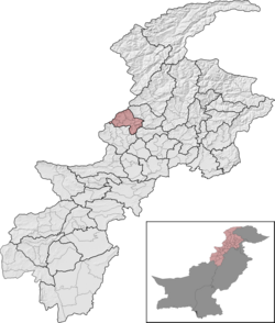
 Bajaur District (red) in Khyber Pakhtunkhwa | |
| Coordinates: 34°41′N 71°30′E / 34.683°N 71.500°E | |
| Country | |
| Province | |
| Division | Malakand |
| Administration HQ | Khar |
| Government | |
| • Type | District Administration |
| • Deputy Commissioner | Muhammad Anwar-ul-Haq[1] |
| Area | |
| • District | 1,290 km2 (500 sq mi) |
| Population (2023)[3] | |
| • District | 1,287,960 |
| • Density | 1,000/km2 (2,600/sq mi) |
| • Urban | 0 |
| • Rural | 1,287,960 |
| Demonym | Bajauri |
| Time zone | UTC+5 (PST) |
| • Summer (DST) | UTC+6 (PDT) |
| Main language | Pashto |
| Number of Tehsils | 7 |
| Website | bajaur |
Bajaur District (Pashto: باجوړ ولسوالۍ, Urdu: ضلع باجوڑ), formerly Bajaur Agency, is a district in the Malakand Division of Khyber Pakhtunkhwa Province, Pakistan. Prior to 2018, Bajaur Agency was the northernmost component of the Federally Administered Tribal Areas (FATA), a semi-autonomous region along the Afghanistan–Pakistan border. In May 2018, FATA was merged into the larger Khyber Pakhtunkhwa Province (KPK) in an attempt to bring stability to the region, redesignating Bajaur Agency to Bajaur District.
The district lies on Pakistan's western border, sharing a 52 km border with Afghanistan's Kunar Province, and lies 35 mi (56 km) north of the Torkham border crossing linking Jalalabad and Peshawar. 498 square kilometer miles in size, Bajaur occupies a small mountain basin and is into seven tehsil (subdistricts) with its district headquarters in the town of Khar, in the district's center. According to the 2017 Pakistani census, Bajaur District has a population of 1,090,987.
- ^ "KP Minister inaugurates IT skills training center at Qadafi". Pakistan Observer. 2023-12-29. Retrieved 2024-01-10.
- ^ Historical and administrative profile of the Bajaur Agency (.fata.gov.pk)
- ^ Cite error: The named reference
2023 censuswas invoked but never defined (see the help page).

