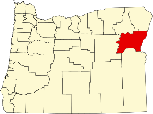
Baker County | |
|---|---|
 Baker County Courthouse in Baker City | |
 Location within the U.S. state of Oregon | |
 Oregon's location within the U.S. | |
| Coordinates: 44°43′N 117°40′W / 44.71°N 117.67°W | |
| Country | |
| State | |
| Founded | September 22, 1862 |
| Named for | Edward D. Baker |
| Seat | Baker City |
| Largest city | Baker City |
| Area | |
• Total | 3,088 sq mi (8,000 km2) |
| • Land | 3,068 sq mi (7,950 km2) |
| • Water | 20 sq mi (50 km2) 0.6% |
| Population (2020) | |
• Total | 16,668 |
• Estimate (2023) | 16,912 |
| • Density | 5.22/sq mi (2.02/km2) |
| Time zone | UTC−8 (Pacific) |
| • Summer (DST) | UTC−7 (PDT) |
| Congressional district | 2nd |
| Website | www |

Baker County is one of the 36 counties in the U.S. state of Oregon. As of the 2020 census, the population was 16,668.[1] The county seat and largest city is Baker City.[2] The county was organized on September 22, 1862, when a portion of Wasco County was partitioned off. The new county's area was reduced in 1864 when Union County was partitioned off, and again in 1887 when Malheur County was partitioned off. The county's lines were last adjusted in 1901 when a parcel was added to the county.
Baker County was named for Edward Dickinson Baker, a senator from Oregon who was killed at Ball's Bluff, a battle of the Civil War in Virginia in 1861. The county is part of the county definition of Eastern Oregon.
- ^ "State & County QuickFacts". United States Census Bureau. Retrieved May 20, 2023.
- ^ "Find a County". National Association of Counties. Archived from the original on May 31, 2011. Retrieved June 7, 2011.
