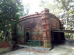
Bakerganj
বাকেরগঞ্জ | |
|---|---|
 Nasrat Gazi Mosque | |
 | |
| Coordinates: 22°33′N 90°20.3′E / 22.550°N 90.3383°E | |
| Country | |
| Division | Barisal |
| District | Barisal |
| Headquarters | Bakerganj |
| Area | |
• Total | 411.36 km2 (158.83 sq mi) |
| Population | |
• Total | 356,022 |
| • Density | 870/km2 (2,200/sq mi) |
| Time zone | UTC+6 (BST) |
| Postal code | 8280[2] |
| Area code | 04328[3] |
| Website | Official Map of the Bakerganj Upazila |
Bakerganj (Bengali: বাকেরগঞ্জ) is an Upazila of Barisal District in the Barisal Division, Bangladesh.[4]
- ^ National Report (PDF). Population and Housing Census 2022. Vol. 1. Dhaka: Bangladesh Bureau of Statistics. November 2023. p. 395. ISBN 978-9844752016.
- ^ "Bangladesh Postal Code". Dhaka: Bangladesh Postal Department under the Department of Posts and Telecommunications of the Ministry of Posts, Telecommunications and Information Technology of the People's Republic of Bangladesh. 21 October 2024.
- ^ "Bangladesh Area Code". China: Chahaoba.com. 18 October 2024.
- ^ Md. Mijanur Rahman (2012). "Bakerganj Upazila". In Sirajul Islam and Ahmed A. Jamal (ed.). Banglapedia: National Encyclopedia of Bangladesh (Second ed.). Asiatic Society of Bangladesh.