Bakka
بكّا Beka, Bekka | |
|---|---|
Village | |
 | |
| Country | |
| Governorate | Beqaa Governorate |
| District | Rashaya District |
| Area | |
• Total | 2.36 sq mi (6.12 km2) |
| Elevation | 4,860 ft (1,480 m) |
| Alternative name | Akbeh, Aqbe, Akbe, Aqbeh |
|---|---|
| Location | 85 kilometres (53 mi) east of Beirut |
| Region | Rashaya |
| Coordinates | 33°35′36″N 35°55′28″E / 33.593334°N 35.924442°E |
| History | |
| Cultures | Roman |
| Site notes | |
| Condition | Ruins |
| Public access | Yes |
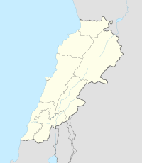
Bakka, Bekka or Beka (Arabic: بكّا) is a village and municipality situated 85 kilometres (53 mi) east of Beirut in the Rashaya District of the Beqaa Governorate in Lebanon.[1][2] The population of the village is Sunni.[3]
- ^ Daniel M. Krencker; Willy Zschietzschmann (1938). Römische Tempel in Syrien: nach Aufnahmen und Untersuchungen von Mitgliedern der Deutschen Baalbekexpedition 1901-1904, pp. 205-269 & pl, 83-116, Otto Puchstein, Bruno Schulz, Daniel Krencker. W. de Gruyter & Co. Retrieved 17 September 2012.
- ^ Ted Kaizer (2008). The Variety of Local Religious Life in the Near East In the Hellenistic and Roman Periods. BRILL. pp. 76–. ISBN 978-90-04-16735-3. Retrieved 20 September 2012.
- ^ "The Monthly - issue 91" (PDF). localiban. p. 7. Archived from the original (PDF) on 4 March 2016. Retrieved 25 December 2015.
