| Ballycastle | |
|---|---|
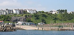
 Ballycastle harbour | |
Location within Northern Ireland | |
| Population | 5,628 (2021 census) |
| Irish grid reference | D115407 |
| • Belfast | 55 miles (89 km) |
| District | |
| County | |
| Country | Northern Ireland |
| Sovereign state | United Kingdom |
| Post town | BALLYCASTLE |
| Postcode district | BT54 |
| Dialling code | 028 |
| Police | Northern Ireland |
| Fire | Northern Ireland |
| Ambulance | Northern Ireland |
| UK Parliament | |
| NI Assembly | |
Ballycastle (from Irish Baile an Chaistil, meaning 'town of the castle')[1][5] is a small seaside town in County Antrim, Northern Ireland. It is on the north-easternmost coastal tip of Ireland, in the Antrim Coast and Glens Area of Outstanding Natural Beauty.
Ballycastle lies at roughly the mid point of the Causeway Coastal Route and is a gateway to both the Glens of Antrim and the North Coast. With a number of attractions on the town's doorstep such as the Giant's Causeway, Carrick-a-Rede Rope Bridge and the Dark Hedges it is a popular destination and stopping point for tourists.[6] The town also benefits from a sweeping bay and beach on its eastern side, with views to Fair Head and Knocklayde mountain dominating the landscape.
The town has been recognised on a number of occasions by The Sunday Times on their "Best Places To Live" list, and has been previously crowned the overall regional winner for Northern Ireland.[7]
The harbour hosts the ferry to Rathlin Island and a smaller passenger and charter service to Campbeltown and Port Ellen in Scotland, with both Rathlin Island and Scotland's Kintyre peninsula able to be seen from the coast. The Ould Lammas Fair is held each year in Ballycastle on the last Monday and Tuesday of August. Ballycastle is the home of the Corrymeela Community.
Ballycastle had a population of 5,628 at the 2021 census.[8] It was the seat and main settlement of the former Moyle District Council.
- ^ a b Ballycastle. Placenames Database of Ireland.
- ^ North-South Ministerial Council: 2002 Annual Report in Ulster Scots Archived 29 August 2011 at the Wayback Machine
- ^ Bonamargy Friary guide – Department of the Environment
- ^ Guide to Dunluce Castle in Ulster-Scots Archived 3 September 2012 at the Wayback Machine DOE.
- ^ Place Names NI
- ^ "Causeway Coast & Glens | Causeway Coastal Route | Discover NI".
- ^ "Ballycastle is Northern Ireland's best place to live in 2022: Proud locals are in full agreement as Co Antrim town edges out Derry and Helen's Bay". Belfasttelegraph.co.uk. 8 April 2022.
- ^ Cite error: The named reference
2021 popwas invoked but never defined (see the help page).
