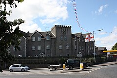
Ballygowan
| |
|---|---|
 | |
Location within County Down | |
| Area | 0.38 sq mi (0.98 km2) |
| Population | 3,138 (2021 Census) |
| • Density | 8,258/sq mi (3,188/km2) |
| Irish grid reference | J4308063725 |
| • Belfast | 8.7 mi (14.0 km) |
| District | |
| County | |
| Country | Northern Ireland |
| Sovereign state | United Kingdom |
| Post town | NEWTOWNARDS |
| Postcode district | BT23 |
| Dialling code | 028 |
| Police | Northern Ireland |
| Fire | Northern Ireland |
| Ambulance | Northern Ireland |
| UK Parliament | |
| NI Assembly | |
| Website | http://www.ballygowan.info |
Ballygowan (from Irish Baile Mhic Gabhann, meaning 'McGowan's townland')[1] is a village in County Down, Northern Ireland. It is within the Ards and North Down Borough. The town of Comber is a short distance to the north-east, the town of Saintfield to the south, and the city of Belfast further to the north-west. It is within the civil parishes of Killinchy and Comber and is split between the historic baronies of Castlereagh Lower and Castlereagh Upper.[2] It had a population of 3,138 people in the 2021 Census.[3]
- ^ Experience ArcGIS
- ^ "Ballygowan". Placenames database of Ireland. Retrieved 21 February 2013.
- ^ "NISRA Census 2021". Census 2021 Results. NI Statistics and Research Agency. Retrieved 21 February 2023.
