This article needs additional citations for verification. (January 2021) |
Ban Phaeo
บ้านแพ้ว | |
|---|---|
 Wat Khlong Tan Rat Bamrung in 2015 | |
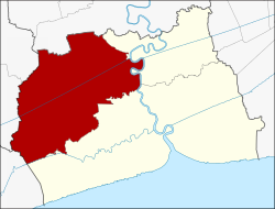
 District location in Samut Sakhon province | |
| Coordinates: 13°35′26″N 100°6′28″E / 13.59056°N 100.10778°E | |
| Country | Thailand |
| Province | Samut Sakhon |
| Area | |
| • Total | 245.031 km2 (94.607 sq mi) |
| Population (2017) | |
| • Total | 98,759 |
| • Density | 403.04/km2 (1,043.9/sq mi) |
| Time zone | UTC+7 (ICT) |
| Postal code | 74120 |
| Geocode | 7403 |
Ban Phaeo (Thai: บ้านแพ้ว, pronounced [bâːn pʰɛ́(ː)w]) is a district (amphoe) in the northern part of Samut Sakhon province, central Thailand.