Ban Phou Pheung Noi | |
|---|---|
 Hmong bamboo house at Ban Phou Pheung Noi | |
| Coordinates: 19°27′6″N 102°59′36″E / 19.45167°N 102.99333°E | |
| Country | Laos |
| Province | Xieng Khouang province |
| founded | 1945 - ended 1969 |
| Elevation | 916 m (3,005 ft) |
| Population | |
| • Total | 310 |


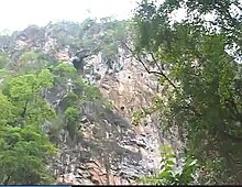
Ban Phou Pheung Noi (Lao: ບ້ານພູເຟືອງນ້ອຍ)[1] is a Laotian village located at the peak of Phou Pheung mountain in the Xieng Khouang province of Laos. Phou Pheung mountain is approximately 916 m (3,005 ft). During the Vietnam War,[2][3] combat between the American allies, the Hmong, and the Pathet Lao, The Laos Marxist government, and the Communist North Vietnamese People's Army took place on the mountain. Phou Pheung mountain runs from east to west and is rocky, and is covered in tropical forests. It is south of Muang Soui - Nongtang-Nato, and west of Phou Douk, Muang Phuan, Phonsavan and Plain of Jars. To the east, about 10 miles from Ban Phou Pheung Noi, is the Num Ngum 4 hydroelectric dam.[4]
Down from the village of Ban Phou Pheung Noi are rocky mountains and the Nam Ngum River, which ran west to the Mekong River in Vientiane province. During the rainy season, navigation between Ban Phou Pheung Noi and its neighbors across the river is almost impossible due to rocky cliffs on both banks of the river. To reach the other side of the river, it is necessary to go miles on foot, which could only be attempted during the dry season.


