Ban Tak
บ้านตาก | |
|---|---|
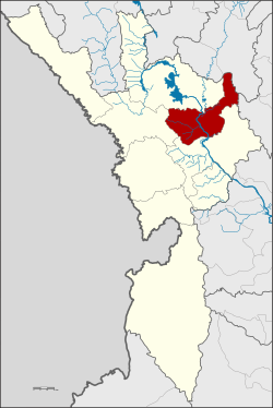
 District location in Tak province | |
| Coordinates: 17°2′36″N 99°4′44″E / 17.04333°N 99.07889°E | |
| Country | Thailand |
| Province | Tak |
| Area | |
• Total | 992.495 km2 (383.204 sq mi) |
| Population (2005) | |
• Total | 46,492 |
| • Density | 46.8/km2 (121/sq mi) |
| Time zone | UTC+7 (ICT) |
| Postal code | 63120 |
| Geocode | 6302 |
Ban Tak (Thai: บ้านตาก, pronounced [bâːn tàːk]) is a district (amphoe) in the northern part of Tak province, western Thailand.