Bang Pakong
บางปะกง | |
|---|---|
 View from Bang Na - Chonburi Expy Tool Road | |
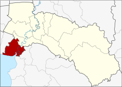
 District location in Chachoengsao province | |
| Coordinates: 13°32′34″N 100°59′38″E / 13.54278°N 100.99389°E | |
| Country | Thailand |
| Province | Chachoengsao |
| Seat | Tha Sa-an |
| Area | |
• Total | 257.893 km2 (99.573 sq mi) |
| Population (2017) | |
• Total | 90,775 |
| • Density | 351.98/km2 (911.6/sq mi) |
| Time zone | UTC+7 (ICT) |
| Postal code | 24130 |
| Geocode | 2404 |
Bang Pakong (Thai: บางปะกง, pronounced [bāːŋ pā.kōŋ]) is a district (amphoe) in the western part of Chachoengsao province in central Thailand.
Bang Pakong District's name comes from the Bang Pakong River. The area has many industrial estates, including the huge gas- and oil-fired Bang Pakong Power Station, and a 180 rai Carabao energy drink production center.[1]