This article needs additional citations for verification. (November 2015) |
Bang Pla Ma
บางปลาม้า | |
|---|---|
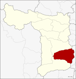
 Amphoe location in Suphan Buri province | |
| Coordinates: 14°24′8″N 100°9′16″E / 14.40222°N 100.15444°E | |
| Country | |
| Province | Suphan Buri |
| Area | |
• Total | 481.3 km2 (185.8 sq mi) |
| Population (2013) | |
• Total | 79,286 |
| • Density | 180.7/km2 (468/sq mi) |
| Time zone | UTC+7 (THA) |
| Postal code | 72150 |
| Geocode | 7204 |
Bang Pla Ma (Thai: บางปลาม้า, pronounced [bāːŋ plāː máː]) is a district (amphoe) in the southern part of Suphan Buri province, central Thailand.