Bang Sao Thong
บางเสาธง | |
|---|---|
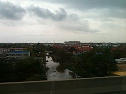
 Klong Bang Krathiam. View from Bang Na - Chonburi Expy Tool Road. | |
 District location in Samut Prakan province | |
| Coordinates: 13°35′42″N 100°49′50″E / 13.59500°N 100.83056°E | |
| Country | Thailand |
| Province | Samut Prakan |
| Seat | Bang Sao Thong |
| Subdistricts | 3 |
| Area | |
| • Total | 114.79 km2 (44.32 sq mi) |
| Population (2017) | |
| • Total | 77,519 |
| • Density | 675.31/km2 (1,749.0/sq mi) |
| Time zone | UTC+7 (ICT) |
| Postal code | 10570 |
| Geocode | 1106 |
Bang Sao Thong (Thai: บางเสาธง; pronounced [bāːŋ sǎw tʰōŋ]) is a district (amphoe) of Samut Prakan province in central Thailand.