| Banna | |
|---|---|
 | |
Location in Cumbria | |
| Known also as | Birdoswald Roman Fort |
| Founded | c. 112 AD |
| Abandoned | c. 500 AD |
| Place in the Roman world | |
| Province | Britannia |
| Location | |
| Coordinates | 54°59′22″N 2°36′08″W / 54.9894°N 2.6023°W |
| County | Cumbria |
| Country | England |
| Website | Birdoswald Roman Fort |

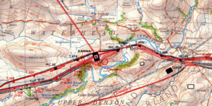
Birdoswald Roman Fort[1] was known as Banna ("peak, horn" in Celtic) in Roman times,[2] reflecting the geography of the site on a triangular spur of land bounded by cliffs to the south and east commanding a broad meander of the River Irthing in Cumbria below.
It lies towards the western end of Hadrian's Wall and is one of the best preserved of the 16 forts along the wall. It is also attached to the longest surviving stretch of Hadrian's Wall.[3]
Cumbria County Council were responsible for the management of Birdoswald fort from 1984 until the end of 2004, when English Heritage assumed responsibility.

- ^ "Research History". Birdoswald Project. 3 June 2021. Retrieved 16 February 2024.
- ^ Rivet, A. L. F.; Smith, Colin (1979). The Place-Names of Roman Britain. London: B. T. Batsford. pp. 261–262. ISBN 0713420774. Retrieved 4 January 2024.
- ^ "Birdoswald Roman Trail Hadrian's Wall". English Heritage. Retrieved 16 February 2024.
