This article needs additional citations for verification. (October 2023) |
Bantwal | |
|---|---|
Taluka | |
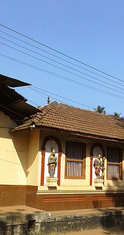
 Kashi Mutt in Bantwal | |
| Coordinates: 12°53′37″N 74°59′41″E / 12.8936°N 74.9947°E | |
| Country | |
| State | Karnataka |
| District | Dakshina Kannada |
| Nearest City | Mangalore |
| Area | |
• Total | 740 km2 (290 sq mi) |
| Elevation | 36 m (118 ft) |
| Population (2011) | |
• Total | 395,380 |
| • Density | 530/km2 (1,400/sq mi) |
| Languages | |
| • Official | Kannada |
| Time zone | UTC+5:30 (IST) |
| PIN | 574 211 |
| Telephone code | 08255 |
| Vehicle registration | KA-70 |
| Website | www |
Bantwal taluk is a taluk of Dakshina Kannada district. The headquarters is the town of Bantwal, an eastern suburb of Mangalore.
Prior to 1852, Bantwal Taluk was the largest taluk in the entire of Canara Province (then comprising North Canara, Udupi, Mangalore and Kasaragod Districts) with 411 villages and a total population of 1,69,416. In 1852, a portion of it was formed into the Taluk of Puttur.[1] Bantwal was an entrepot for the produce of the province on its way to the Mysore Country and had derived a great benefit of late years from the extension of the coffee trade. It contained about thousand scattered houses inhabited by Billava, Bunts, Bhandary, Ganigas, Kulals, Goud Saraswat Brahmins, Konkani Catholics and a few Jains.[1]
