Barbu Municipality
Barbu kommune | |
|---|---|
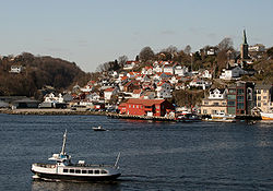
 View of Barbu | |
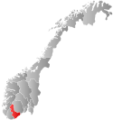
 Aust-Agder within Norway | |
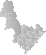
 Barbu within Aust-Agder | |
| Coordinates: 58°27′59″N 08°46′41″E / 58.46639°N 8.77806°E | |
| Country | Norway |
| County | Aust-Agder |
| District | Østre Agder |
| Established | 1 Jan 1878 |
| • Preceded by | Østre Moland Municipality |
| Disestablished | 1 Jan 1902 |
| • Succeeded by | Arendal Municipality |
| Administrative centre | Barbu |
| Area (upon dissolution)[1] | |
• Total | 15.3 km2 (5.9 sq mi) |
| Population (1902) | |
• Total | 6,787 |
| • Density | 440/km2 (1,100/sq mi) |
| Time zone | UTC+01:00 (CET) |
| • Summer (DST) | UTC+02:00 (CEST) |
| ISO 3166 code | NO-0990[2] |
Barbu is a former municipality in the old Aust-Agder county in Norway. Today, it is part of the is part of the town of Arendal in Agder county. The 15.3-square-kilometre (5.9 sq mi) municipality existed from 1878 until 1902 when it was merged into the town of Arendal. The municipality was located just to the north of what was then the 0.34-square-kilometre (84-acre) town of Arendal. The administrative centre of the small, urban municipality was called Barbu as well. Barbu Church was the church for the municipality.[3]
Today, the name Barbu refers to the village-like place located in head of the Galtesundet strait within the town of Arendal. Barbu is also a parish (sogn) in the Arendal prosti (deanery) within the Diocese of Agder og Telemark.[1]
- ^ a b Kiær, Anders Nicolai; Helland, Amund; Vibe, Johan; Strøm, Boye (1904). "Arendal by". Norges land og folk: Nedenes amt (in Norwegian). Norway: H. Aschehoug & Company. p. 26. Retrieved 29 November 2017.
- ^ Bolstad, Erik; Thorsnæs, Geir, eds. (26 January 2023). "Kommunenummer". Store norske leksikon (in Norwegian). Kunnskapsforlaget.
- ^ Thorsnæs, Geir, ed. (21 June 2015). "Barbu – tidligere kommune i Aust-Agder". Store norske leksikon (in Norwegian). Kunnskapsforlaget. Retrieved 29 November 2017.