This article needs additional citations for verification. (May 2011) |
Barclay | |
|---|---|
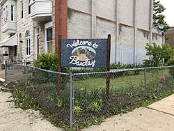
 Barclay neighborhood welcome sign | |
| Coordinates: 39°18′54″N 76°36′42″W / 39.3150°N 76.6117°W | |
| Country | United States |
| State | Maryland |
| City | Baltimore |
| Area | |
| • Total | .138 sq mi (0.36 km2) |
| • Land | .138 sq mi (0.36 km2) |
| [1] | |
| Population (2010)[1] | |
| • Total | 2,697 |
| Time zone | UTC-5 (Eastern) |
| • Summer (DST) | EDT |
| ZIP code | 21218 |
| Area code | 410, 443, and 667 |
Barclay is a neighborhood in the center of Baltimore City. Its boundaries, as defined by the City Planning Office, are marked by North Avenue, Greenmount Avenue, Saint Paul and 25th Streets. The neighborhood lies north of Greenmount West, south of Charles Village, west of East Baltimore Midway, and east of Charles North and Old Goucher.[1] The boundary between the Northern and Eastern police districts runs through the community, cutting it roughly in half.
- ^ a b c "Barclay neighborhood in Baltimore, Maryland". City-Data.com. Retrieved January 29, 2015.
