Barisal
বরিশাল | |
|---|---|
| Barishal | |
|
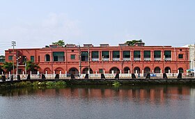
From top: Barisal Launch Terminal, University of Barisal, Guthia Mosque, Oxford Mission Church, Brojomohun College, Barisal Museum | |
| Nickname: Venice of the East | |
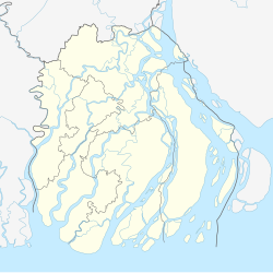
Location of Barisal in Bangladesh | |
| Coordinates: 22°42′36″N 90°21′47″E / 22.710°N 90.363°E | |
| Country | Bangladesh |
| Division | Barisal Division |
| District | Barisal District |
| Municipality established | 1876 |
| City Corporation | 2002 |
| Granted city status | 19 April 2001[1] |
| Government | |
| • Type | Mayor–Council |
| • Body | Barishal City Corporation |
| • Police commissioner | Md. Saiful Islam, BPM(Bar) |
| Area | |
| • Urban | 58 km2 (22 sq mi) |
| Elevation | 1 m (4 ft) |
| Population (2011)[3] | |
| 328,278 | |
| • Density | 10,524/km2 (27,260/sq mi) |
| • Metro | 385,093 |
| Demonym(s) | Barishali, Barishailla |
| Time zone | UTC+6 (BST) |
| Postal code | 8200 |
| Calling code | 0431 |
| National calling code | +880 |
| Police | Barisal Metropolitan Police |
| Domestic airport | Barisal Airport |
| Website | www |
Barisal (/ˌbʌr əˈsɑːl/ or /ˈbær əˌsɔːl/; Bengali: বরিশাল, pronounced [boɾiʃal]),[a] officially known as Barishal,[4] is a major city that lies on the banks of the Kirtankhola river in south-central Bangladesh. It is the largest city and the administrative headquarter of both Barisal District[b] and Barisal Division. It is one of the oldest municipalities and river ports of the country. The city was once called the Venice of the East or the Venice of Bengal.[6]
Barisal municipality was established in 1876 during the British rule in India and upgraded to City Corporation on 25 July 2002.[7] Barisal is Bangladesh's third largest financial hub after Dhaka and Chittagong.[8][9] The city consists of 30 wards and 50 mahallas with a population of 533,000, according to the 2023 national census and with the voter of about 250,000 according to the 2018 voter list of city election.[10] The area of the city is 58 km2.[11]
- ^ "Barisal City Master Plan". Urban Development Directorate - Government of Bangladesh. Archived from the original on 14 April 2015. Retrieved 14 April 2015.
- ^ "Barisal City Corporation, Bangladesh" (PDF). ICLEI. Archived from the original (PDF) on 12 April 2015. Retrieved 12 April 2015.
- ^ "Population & Housing Census-2011" (PDF). Bangladesh Bureau of Statistics. p. 38. Archived from the original (PDF) on 8 December 2015. Retrieved 15 December 2015.
- ^ a b "Bangladesh changes English spellings of five districts". Bdnews24.com. Dhaka. 2 April 2018. Archived from the original on 2023-06-06. Retrieved 2 April 2018.
- ^ Mahadi Al Hasnat (2 April 2018). "Mixed reactions as govt changes English spellings of 5 district names". Dhaka Tribune. Retrieved 8 April 2018.
- ^ "Our Cities: Beyond the Capital". 15th Anniversary Special. The Daily Star. 10 February 2006. Archived from the original on 2 November 2021. Retrieved 7 December 2016.
- ^ Tapan Palit (2012). "Barisal City Corporation". In Sirajul Islam and Ahmed A. Jamal (ed.). Banglapedia: National Encyclopedia of Bangladesh (Second ed.). Asiatic Society of Bangladesh.
- ^ "Padma Bridge injects fresh blood in southern economy". The Business Standard. 2022-09-18. Retrieved 2023-05-27.
- ^ "Padma Bridge biggest shot in economy's arm". New Age. Retrieved 2023-05-27.
- ^ "Barisal, Bangladesh Metro Area Population 1950-2023". www.macrotrends.net. Retrieved 2023-05-27.
- ^ "Barisal City Corporation". Barisal City Corporation. Archived from the original on 2013-07-23. Retrieved 2014-09-19.
Cite error: There are <ref group=lower-alpha> tags or {{efn}} templates on this page, but the references will not show without a {{reflist|group=lower-alpha}} template or {{notelist}} template (see the help page).


