This article needs additional citations for verification. (October 2009) |
Barisal District
বরিশাল জেলা | |
|---|---|
| Barishal District | |
|
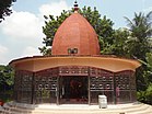
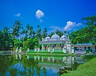
From top: City skyline, Guthia Mosque, Durga Sagar lake, Oxford Mission Church, Brojomohun College, Bell's Park aka Bangabandhu Udyan, Kasba Mosque, Paddle steamer at Kirtonkhola River port, Satlar Bil, Manasa Mandir of Bijoy Gupta and Ulania Zamnindar Bari Mosque. | |
 Location of Barisal District in Bangladesh | |
 Expandable map of Barisal District | |
| Coordinates: 22°48′N 90°22′E / 22.80°N 90.37°E | |
| Country | |
| Division | Barisal |
| Bakerganj District | 1797 |
| Seat | Barisal |
| Government | |
| • Deputy Commissioner | S.M. Ajior Rahman |
| • District Council Chairman | Md. Moidul Islam[1] |
| • Chief Executive Officer | Md. Monik-har Rahman |
| Area | |
• Total | 2,784.52 km2 (1,075.11 sq mi) |
| Elevation | 4 m (13 ft) |
| Highest elevation | 14 m (46 ft) |
| Lowest elevation | −4 m (−4 ft) |
| Population | |
• Total | 2,570,446 |
| • Density | 920/km2 (2,400/sq mi) |
| • Male | 1,255,436 [3] |
| • Female | 1,314,935 [3] |
| Demonyms | Barishali, Barishailla |
| Time zone | UTC+06:00 (BST) |
| Postal code | 8200 |
| Area code | 0431 |
| ISO 3166 code | BD-06 |
| HDI (2018) | 0.672[4] medium · 2nd of 21 |
Barisal District, officially spelled Barishal District from April 2018,[5] is a district in south-central Bangladesh, formerly called Bakerganj district, established in 1797.[6] Its headquarters are in the city of Barisal, which is also the headquarters of Barisal Division.[7]
- ^ barisal.gov.bd
- ^ a b c "Barisal District topographic map". topographic-map.com. Retrieved 3 October 2024.
- ^ a b c Cite error: The named reference
2022censuswas invoked but never defined (see the help page). - ^ "Sub-national HDI - Area Database - Global Data Lab". hdi.globaldatalab.org. Retrieved 18 March 2020.
- ^ Mahadi Al Hasnat (2 April 2018). "Mixed reactions as govt changes English spellings of 5 district names". Dhaka Tribune. Archived from the original on 6 February 2024. Retrieved 8 April 2018.
- ^ KAM Saiful Islam (2012). "Barisal District". In Sirajul Islam and Ahmed A Jamal (ed.). Banglapedia: National Encyclopedia of Bangladesh (Second ed.). Asiatic Society of Bangladesh.
- ^ About Barisal Archived 20 January 2017 at the Wayback Machine Local Government Engineering Department, Local Government Division, Ministry of Local Government, Rural Development & Cooperatives; retrieved 14 May 2014.


