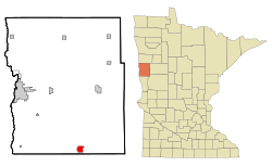
Barnesville | |
|---|---|
Old City Hall Old City Jail Patterson-Hernandez House | |
 | |
| Coordinates: 46°39′00″N 96°24′58″W / 46.65000°N 96.41611°W | |
| Country | United States |
| State | Minnesota |
| County | Clay |
| Established | 1874 |
| Incorporated (village) | November 4, 1881 |
| Incorporated (city) | April 4, 1889 |
| Government | |
| • Mayor | Jason Rick |
| Area | |
| • Total | 2.14 sq mi (5.54 km2) |
| • Land | 2.12 sq mi (5.49 km2) |
| • Water | 0.02 sq mi (0.05 km2) |
| Elevation | 1,030 ft (314 m) |
| Population | |
| • Total | 2,759 |
| • Estimate (2022)[4] | 2,781 |
| • Density | 1,301.42/sq mi (502.45/km2) |
| Time zone | UTC–6 (Central (CST)) |
| • Summer (DST) | UTC–5 (CDT) |
| ZIP code | 56514 |
| Area code | 218 |
| FIPS code | 27-03574 |
| GNIS feature ID | 2394065[2] |
| Sales tax | 7.375%[5] |
| Website | barnesvillemn.com |
Barnesville is a city in Clay County, Minnesota, United States. The population was 2,759 at the 2020 census.[3]
Barnesville Potato Days is held annually in August.
Interstate 94/U.S. Highway 52, as well as Minnesota State Highways 9 and 34 are four of the main routes in the city.
- ^ "2020 U.S. Gazetteer Files". United States Census Bureau. Retrieved July 24, 2022.
- ^ a b U.S. Geological Survey Geographic Names Information System: Barnesville, Minnesota
- ^ a b "Explore Census Data". United States Census Bureau. Retrieved January 2, 2024.
- ^ Cite error: The named reference
USCensusEst2022was invoked but never defined (see the help page). - ^ "Barnesville (MN) sales tax rate". Retrieved January 2, 2024.


