Barnstable County | |
|---|---|
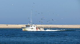
Images, from top down, left to right: Nauset Light in Eastham; View of the Kennedy Compound; The Bourne Bridge; Boat off of Chatham | |
 Location within the U.S. state of Massachusetts | |
 Massachusetts's location within the U.S. | |
| Coordinates: 41°41′56″N 70°18′07″W / 41.698997°N 70.301811°W | |
| Country | |
| State | |
| Founded | June 2, 1685 |
| Named for | Town of Barnstable |
| Seat | Barnstable |
| Largest city | Barnstable |
| Area | |
• Total | 1,306 sq mi (3,380 km2) |
| • Land | 394 sq mi (1,020 km2) |
| • Water | 912 sq mi (2,360 km2) 70% |
| Population (2020) | |
• Total | 228,996 |
| • Density | 580.9/sq mi (224.3/km2) |
| Time zone | UTC−5 (Eastern) |
| • Summer (DST) | UTC−4 (EDT) |
| Congressional district | 9th |
| Website | www |
Barnstable County is a county in the U.S. state of Massachusetts. At the 2020 census, the population was 228,996.[1] The county seat is Barnstable.[2] The county consists of Cape Cod and associated islands (some adjacent islands are in Dukes County and Nantucket County).
Barnstable County was formed as part of the Plymouth Colony on June 2, 1685, including the towns of Falmouth, Sandwich, and others to the east and north on Cape Cod. Plymouth Colony was merged into the Province of Massachusetts Bay in 1691.
- ^ "2020 Census Demographic Data Map Viewer". United States Census Bureau. Retrieved August 12, 2021.
- ^ "Find a County". National Association of Counties. Archived from the original on July 4, 2012. Retrieved June 7, 2011.


