| Barraba New South Wales | |||||||||
|---|---|---|---|---|---|---|---|---|---|
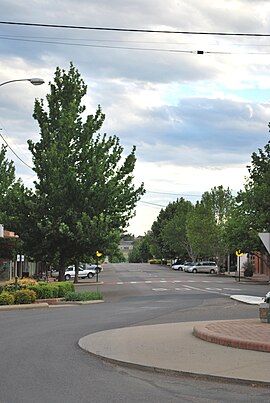
 The main street of Barraba | |||||||||
| Coordinates | 30°22′42″S 150°36′38″E / 30.37833°S 150.61056°E | ||||||||
| Population | 1,410 (2016 census)[1] | ||||||||
| Established | 1850s | ||||||||
| Postcode(s) | 2347 | ||||||||
| Elevation | 500 m (1,640 ft) | ||||||||
| Location | |||||||||
| LGA(s) | Tamworth Regional Council | ||||||||
| County | Darling | ||||||||
| State electorate(s) | Tamworth | ||||||||
| Federal division(s) | New England | ||||||||
| |||||||||
Barraba /ˈbærəbə/[2] is a town in the New England region of northern New South Wales, Australia. It was formerly the centre of Barraba Shire local government area, but most of this, including Barraba, was absorbed into Tamworth Regional Council in 2004. On Census night 2016, Barraba had a population of approximately 1,400 people.[1] It is part of the Bundarra-Barraba Important Bird Area which is important for the conservation of the endangered regent honeyeater.
The town was the termination point for the Barraba branch railway line until it was closed.
- ^ a b "2016 Census QuickStats – Barraba (State Suburb)". Australian Bureau of Statistics. 6 July 2018. Retrieved 18 August 2018.
- ^ Macquarie Dictionary, Fourth Edition (2005). Melbourne, The Macquarie Library Pty Ltd. ISBN 1-876429-14-3
