| Barry Point Fire | |
|---|---|
 Firefighters patrolling the fire line | |
| Date(s) |
|
| Location | Lake County, Oregon & Modoc County, California |
| Coordinates | 42°06′40″N 120°48′06″W / 42.1111°N 120.8018°W |
| Statistics | |
| Burned area | 92,977 acres (376 km2) |
| Impacts | |
| Non-fatal injuries | 3 |
| Structures destroyed | 3 |
| Damage | $23.2 million |
| Ignition | |
| Cause | Lightning |
| Map | |
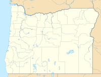
The Barry Point Fire was a wildfire that burned over 92,977 acres (376.26 km2) of Oregon and California forest land during the summer of 2012. The fire began on 5 August 2012, the result of a lightning strike. The fire consumed public forest and rangeland as well as private forest and grazing land located in Lake County, Oregon and Modoc County, California. The public lands affected by the fire are administered by the United States Forest Service and the Oregon Department of Forestry. The largest part of the private land was owned by the Collins Timber Company. At the peak of the firefighting effort, there were 1,423 personnel working on the fire. It took 22 days to fully contain the fire and then an additional three weeks to mop it up.
