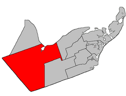
Bathurst | |
|---|---|
 Location within Gloucester County, New Brunswick | |
| Coordinates: 47°28′N 65°52′W / 47.46°N 65.86°W | |
| Country | |
| Province | |
| County | Gloucester |
| Erected | 1827 |
| Area | |
| • Land | 1,502.74 km2 (580.21 sq mi) |
| Population (2021)[1] | |
• Total | 4,761 |
| • Density | 3.2/km2 (8/sq mi) |
| • Change 2016-2021 | |
| • Dwellings | 2,293 |
| Time zone | UTC-4 (AST) |
| • Summer (DST) | UTC-3 (ADT) |
| Figures do not include portions within the city of Bathurst, the town of Beresford, and the Pabineau 11 Indian reserve | |
Bathurst is a geographic parish in Gloucester County, New Brunswick, Canada.[4]
For governance purposes, the parish is divided between the city of Bathurst, the town of Belle-Baie,[5] and the Chaleur rural district,[6] as well as the Pabineau 11 Indian reserve; the city, town, and village are all part of the Chaleur Regional Service Commission.[7]
Prior to the 2023 governance reform, the parish was divided between Bathurst, the town of Beresford, the Indian reserve, and six local service districts: Allardville, Big River, Dunlop, New Bandon-Salmon Beach, North Tetagouche, and the parish of Bathurst;[8] In the 2023 reform,[9] Bathurst annexed most of North Tetagouche, the northern part of Big River, a part of New Bandon-Salmon Beach along Currie Street, and parts of the LSD of the parish of Bathurst including the communities of Chamberlain Settlement, Gloucester Junction, and Sainte-Anne;[5] Beresford became part of Belle-Baie, annexing Dunlop and small parts of the parish LSD;[5] Allardville and the remaining parts of Big River, New Bandon-Salmon Beach, and the parish LSD became part of the rural district.[6]
- ^ a b "Census Profile". Statistics Canada. 26 October 2022. Retrieved 29 October 2022.
- ^ "Chapter T-3 Territorial Division Act". Government of New Brunswick. Retrieved 27 January 2023.
- ^ "Chapter I-13 Interpretation Act". Government of New Brunswick. Retrieved 27 January 2023.
- ^ The Territorial Division Act[2] divides the province into 152 parishes, the cities of Saint John and Fredericton, and one town of Grand Falls. The Interpretation Act[3] clarifies that parishes include any local government within their borders.
- ^ a b c d "Chaleur Regional Service Commission: RSC 3". Government of New Brunswick. Retrieved 27 January 2023.
- ^ a b "Chaleur rural district: RD 3". Government of New Brunswick. Retrieved 27 January 2023.
- ^ "Regions Regulation – Regional Service Delivery Act". Government of New Brunswick. 21 July 2022. Retrieved 27 January 2023.
- ^ "Local Service Districts Regulation - Municipalities Act". Government of New Brunswick. 25 June 2021. Retrieved 27 January 2023.
- ^ The original white paper maps showed the existing and proposed governance boundaries; these maps are still visible as thumbnails on the provincial government map page.[5]