| Battersby | |
|---|---|
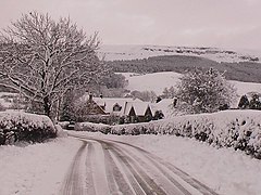
 Approaching Battersby in winter | |
Location within North Yorkshire | |
| OS grid reference | NZ5907 |
| Unitary authority | |
| Ceremonial county | |
| Region | |
| Country | England |
| Sovereign state | United Kingdom |
| Post town | MIDDLESBROUGH |
| Postcode district | TS9 |
| Police | North Yorkshire |
| Fire | North Yorkshire |
| Ambulance | Yorkshire |
| UK Parliament | |
Battersby is a hamlet in North Yorkshire, England. It lies on the edge of the North York Moors National Park and within the historic boundaries of the North Riding of Yorkshire, 5 miles (8 km) east of Stokesley, and 1.5 miles (2.4 km) south-west of Kildale.[1][2] The settlement is mentioned in the Domesday Book as being part of the hundred of Langbaurgh, and having one ploughland.[3] The name is recorded in 1086 as Badresbi, and in the 14th century as Batheresby. The first part is an Old Norse name (Bothvar or Boðvarr), and the by means farmstead.[4][5] In the Late Middle Ages a watermill was employed on the local beck (Otter Hills Beck, and affluent of the River Leven) to grind corn.[6]
Until 1974, the hamlet was in the North Riding of Yorkshire, part of the Stokesley Rural District, being transferred to the Hambleton District of the newer county of North Yorkshire.[7] In 2023 the districts were abolished to be replaced by the North Yorkshire Unitary authority. It is now part of the civil parish of Ingleby Greenhow, and is represented at the Houses of Parliament as part of the Richmond Constituency.[8]
- ^ "Genuki: Ingleby Greenhow, Yorkshire (North Riding)". genuki.org.uk. Retrieved 27 November 2023.
- ^ Pevsner, Nikolaus (2002) [1966]. Yorkshire, the North Riding. London: Yale University Press. p. 74. ISBN 0-300-09665-8.
- ^ "Battersby | Domesday Book". opendomesday.org. Retrieved 27 November 2023.
- ^ Ekwall, Eilert (1960). The concise Oxford dictionary of English place-names (4 ed.). Oxford: Oxford University Press. p. 31. ISBN 0-19-869103-3.
- ^ Smith, A. H. (1979) [1928]. The Place Names of the North Riding of Yorkshire. English Place Name Society. p. 167. OCLC 19714705.
- ^ Page, William (1968). The Victoria history of the county of York, North Riding. London: Dawsons of Pall Mall for the University of London Institute of Historical Research. p. 245. ISBN 0712903100.
- ^ GUIDE NO. 6 NORTH YORKSHIRE GAZETTEER OF TOWNSHIPS AND PARISHES. Northallerton: North Yorkshire County Council. 2021. pp. 3, 5, 18. ISBN 0 906035 29 5.
- ^ "Election Maps". ordnancesurvey.co.uk. Retrieved 27 November 2023.
On the left of the screen is the "Boundary" tab; click this and activate either civil parishes or Westminster Constituencies (or both), however, only two functions can be active at any one time.
