| Battle | |
|---|---|
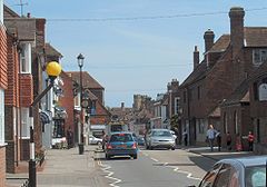
 View along the High Street towards the abbey | |
Location within East Sussex | |
| Area | 31.8 km2 (12.3 sq mi) [1] |
| Population | 6,800 (2021)[2] |
| • Density | 503/sq mi (194/km2) |
| OS grid reference | TQ747160 |
| • London | 48 miles (77 km) NNW |
| District | |
| Shire county | |
| Region | |
| Country | England |
| Sovereign state | United Kingdom |
| Post town | BATTLE |
| Postcode district | TN33 |
| Dialling code | 01424 |
| Police | Sussex |
| Fire | East Sussex |
| Ambulance | South East Coast |
| UK Parliament | |
| Website | Town Council |
Battle is a town and civil parish in the district of Rother in East Sussex, England. It lies 50 miles (80 km) south-east of London, 27 miles (43 km) east of Brighton and 20 miles (32 km) east of Lewes. Hastings is to the south-east and Bexhill-on-Sea to the south. Battle is in the designated High Weald Area of Outstanding Natural Beauty. The parish population was 6,673 according to the 2011 Census[2] and 6,800 in the 2021 census.[3] Battle contains the site of, and is named after, the Battle of Hastings, where William, Duke of Normandy, defeated King Harold II to become William I of England in 1066. For some 250 years after 1066, official documents referred to the town as (Latin) Bellum or (French) Bataille.
- ^ "East Sussex in Figures". East Sussex County Council. Archived from the original on 28 December 2012. Retrieved 26 April 2008.
- ^ a b "Town population 2011". Neighbourhood Statistics. Office for National Statistics. Archived from the original on 4 March 2016. Retrieved 6 October 2015.
- ^ ONS (2024). "2021 census".
