| Bay City State Park | |
|---|---|
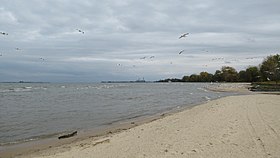
 Beachfront along Saginaw Bay | |
| Location | Bay County, Michigan, United States |
| Nearest city | Bay City, Michigan |
| Coordinates | 43°39′58″N 83°54′19″W / 43.66611°N 83.90528°W |
| Area | 2,389 acres (967 ha) |
| Elevation | 584 feet (178 m) |
| Established | 1922 |
| Administered by | Michigan Department of Natural Resources |
| Website | Official website |

Bay City State Park (previously Bay City State Recreation Area) is a 2,389-acre (967 ha) state park located on the shore of Saginaw Bay near Bay City in Bay County, Michigan, United States. The Tobico Marsh, one of the largest remaining freshwater, coastal wetlands on the Great Lakes is located in the park. Other natural features of the park include a mile of sandy beach, over 2,000 acres (810 ha) of wetland woods, meadows, oak savannah prairies, and cattail marshes. The park is a haven for migratory birds and wetland wildlife.[1]

