Bayt Dajan
بيت دجن Beit Dajan, Bait Dajan, Dajūn, Beit Dejan | |
|---|---|
![Bayt Dajan, before 1935. From the Khalil Raad-collection.[1]](http://upload.wikimedia.org/wikipedia/commons/thumb/2/23/Bait_Dajan.jpg/200px-Bait_Dajan.jpg) Bayt Dajan, before 1935. From the Khalil Raad-collection.[1] | |
| Etymology: "The house of Dagon"[2] | |
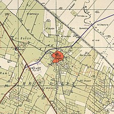
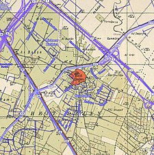
A series of historical maps of the area around Bayt Dajan (click the buttons) | |
Location within Mandatory Palestine | |
| Coordinates: 32°0′13″N 34°49′46″E / 32.00361°N 34.82944°E | |
| Palestine grid | 134/156 |
| Geopolitical entity | Mandatory Palestine |
| Subdistrict | Jaffa |
| Date of depopulation | 25 April 1948[4] |
| Area | |
| • Total | 17,327 dunams (17.327 km2 or 6.690 sq mi) |
| Population (1945) | |
| • Total | 3,840[3] |
| Cause(s) of depopulation | Influence of nearby town's fall |
| Current Localities | Beit Dagan[6][7] Mishmar HaShiv'a[7] Hemed[7] Ganot[7] |
Bayt Dajan (Arabic: بيت دجن, romanized: Bayt Dajan; Hebrew: בית דג'ן), also known as Dajūn, was a Palestinian Arab village situated approximately 6 kilometers (3.7 mi) southeast of Jaffa. It is thought to have been the site of the biblical town of Beth Dagon, mentioned in the Book of Joshua and in ancient Assyrian and Ancient Egyptian texts. In the 10th century CE, it was inhabited mostly by Samaritans.
In the mid-16th century, Bayt Dajan formed part of an Ottoman waqf established by Roxelana, the wife of Suleiman the Magnificent, and by the late 16th century, it was part of the nahiya of Ramla in the liwa of Gaza. The villagers, who were all recorded as Muslim, paid taxes to the Ottoman authorities for property and agricultural goods and animal husbandry conducted in the villages, including the cultivation of wheat, barley, fruit, and sesame, as well as on goats, beehives and vineyards. In the 19th Century, the village women were also locally renowned for the intricate, high quality embroidery designs, a ubiquitous feature of traditional Palestinian costumes.
By the time of the Mandatory Palestine, the village housed two elementary schools, a library and an agronomic school. After an assault by the Alexandroni Brigade during Operation Hametz on 25 April 1948 in the lead up to the 1948 Arab–Israeli war, the village was entirely depopulated.[8] The Israeli town of Beit Dagan was founded at the same site in October 1948.[9]
Another Bayt Dajan, not to be confused with this one, is located southeast of Nablus.[10]
- ^ Khalidi, 1992, pp. 231, 605, 606
- ^ Palmer, 1881, p. 213
- ^ Government of Palestine, Department of Statistics, 1945, p. 27
- ^ Morris, 2004, p. xviii, village #219. Also gives cause(s) of depopulation.
- ^ Cite error: The named reference
Hadawi52was invoked but never defined (see the help page). - ^ Morris, 2004, p. xxi, Settlement #91.
- ^ a b c d Cite error: The named reference
Khalidi3was invoked but never defined (see the help page). - ^ "Welcome to Bayt Dajan". Palestine Remembered. Retrieved 2007-12-04.
- ^ Gelber, 2006, p. 394.
- ^ Cite error: The named reference
Smithp396was invoked but never defined (see the help page).


