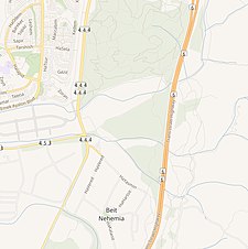
Bayt Nabala
بيت نبالا Bayt Nabala, Beit-Nabbala | |
|---|---|
 Former schoolhouse of Bayt Nabala, presently used by the Jewish National Fund in Beit Nehemia | |
| Etymology: "The house of archery"[1] | |
A series of historical maps of the area around Bayt Nabala (click the buttons) | |
Location within Mandatory Palestine | |
| Coordinates: 31°59′8″N 34°57′24″E / 31.98556°N 34.95667°E | |
| Palestine grid | 146/154 |
| Geopolitical entity | Mandatory Palestine |
| Subdistrict | Ramle |
| Date of depopulation | 13 May 1948[4] |
| Area | |
• Total | 15,051 dunams (15.051 km2 or 5.811 sq mi) |
| Population (1945) | |
• Total | 2,310[2][3] |
| Cause(s) of depopulation | Abandonment on Arab orders |
| Current Localities | Kfar Truman,[5] and Beit Nehemia[5] |
Bayt Nabala or Beit Nabala was a Palestinian Arab village in the Ramle Subdistrict in Palestine that was destroyed during the 1948 Arab–Israeli War. The village was in the territory allotted to the Arab state under the 1947 UN Partition Plan, which was rejected by Arab leaders and never implemented.[6][7][8] Its population in 1945, before the war, was 2,310.
It was occupied by Israeli forces on 13 May 1948[4] and was completely destroyed by them on 13 September 1948.[9] Village refugees were scattered around Deir 'Ammar, Ramallah city, Bayt Tillow, Rantis, and Jalazone refugee camps north of Ramallah. Some of the clans that lived in Bayt Nabala include the AlHeet, Nakhleh, Safi, AL-Sharaqa, al-Khateeb, Saleh and Zaid families. Today the area is part of the Israeli town of Beit Nehemia.
- ^ Palmer, 1881, p. 226
- ^ Department of Statistics, 1945, p. 29
- ^ a b Government of Palestine, Department of Statistics. Village Statistics, April, 1945. Quoted in Hadawi, 1970, p. 66
- ^ a b Morris, 2004, p. xix, village #222. Also gives the cause for depopulation.
- ^ a b Khalidi, 1992, p. 366
- ^ Rogan, Eugene (2012). The Arabs: A History (3rd ed.). Penguin. p. 321. ISBN 978-0-7181-9683-7.
- ^ Morris, Benny (2008). 1948: A History of the First Arab-Israeli War. Yale University Press. p. 73. ISBN 978-0-300-12696-9.
- ^ Galnoor, Itzhak (1995). The Partition of Palestine: Decision Crossroads in the Zionist Movement. State University of New York Press. p. 289. ISBN 978-0-7914-2193-2.
- ^ Morris, 2004, p. 354.


