Beast Cliff | |
|---|---|
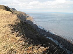
 Looking north along Beast Cliff showing the intermediate plateau aligned with the horizon (2012) | |
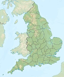
| Coordinates: 54°22′50″N 0°27′34″W / 54.380501°N 0.459452°W | |
| Grid position | TA0099 |
| Topo map | OS Explorer OL27 |
Beast Cliff is a steep sea cliff situated about halfway between Whitby and Scarborough on the coast of North Yorkshire in northeastern England. Beast Cliff is at the southern end of a coastal region designated as a Special Area of Conservation and Site of Special Scientific Interest. Bordering the eastern edge of the North York Moors national park, the Cleveland Way runs at the head of the cliffs.
In terms of its position on the Ordnance Survey National Grid system of geographical mapping, Beast Cliff is mostly in the one-kilometre grid square TA0099 but at its northern end it extends into OV. That point is the only area of land in the entire 100-kilometre national grid square of OV, adjoining NZ, SE and TA.
