Bedford | |
|---|---|
 | |
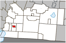
 Location within Brome-Missisquoi RCM. | |
| Coordinates: 45°07′N 72°59′W / 45.117°N 72.983°W[1] | |
| Country | Canada |
| Province | Quebec |
| Region | Estrie |
| RCM | Brome-Missisquoi |
| Constituted | November 21, 1866 |
| Government | |
| • Mayor | Claude Dubois |
| • Federal riding | Brome—Missisquoi |
| • Prov. riding | Brome-Missisquoi |
| Area | |
• Total | 4.40 km2 (1.70 sq mi) |
| • Land | 4.20 km2 (1.62 sq mi) |
| Elevation | 53 m (174 ft) |
| Population (2011)[4] | |
• Total | 2,684 |
| • Density | 639.4/km2 (1,656/sq mi) |
| • Pop 2006-2011 | |
| • Dwellings | 1,276 |
| Time zone | UTC−5 (EST) |
| • Summer (DST) | UTC−4 (EDT) |
| Postal code(s) | |
| Area code(s) | 450 and 579 |
| Highways | |
| Exchange# | 248 |
| GNBC Code | EFMFP |
| NTS Map | 31H2 Cowansville |
| Geocode | 2446035 |
| People | Bedfordite |
Bedford (French pronunciation: [bɛdfœʁd]) is a city located in the Estrie region of southern Quebec, Canada. The population as of the Canada 2011 Census was 2,684. This small community is just an hour's drive from larger cities such as Burlington and Montreal.
- ^ Cite error: The named reference
toponymiewas invoked but never defined (see the help page). - ^ a b "Ministère des Affaires municipales, des Régions et de l'Occupation du territoire: Frelighsburg". Archived from the original on 2012-05-06. Retrieved 2012-03-11.
- ^ "Parliament of Canada Federal Riding History: BROME--MISSISQUOI (Quebec)". Archived from the original on 2009-06-09. Retrieved 2009-04-20.
- ^ a b 2011 Statistics Canada Census Profile: Bedford, Quebec
