Beekdaelen
Baekdale | |
|---|---|
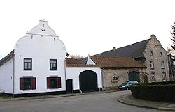
 Old farmhouse in Arensgenhout | |
 Location in Limburg | |
| Coordinates: 50°55′N 5°53′E / 50.917°N 5.883°E | |
| Country | Netherlands |
| Province | Limburg |
| Government | |
| • Body | Municipal council |
| • Mayor | Eric Geurts (PvdA) |
| Time zone | UTC+1 (CET) |
| • Summer (DST) | UTC+2 (CEST) |
| Postcode | 6155, 6174, 6365, 6436-6439 |
| Area code | 045, 046 |
| Website | www |
Beekdaelen (Dutch: [beːɡˈdaːlə(n)] ; Limburgish: Baekdale [bɛːɡˈdaːlə])[tone?] is a municipality in the province of Limburg, situated in the southern Netherlands. It was formed as a merger of Nuth, Onderbanken and Schinnen.[2]
Beekdaelen has 35,853 inhabitants. It does not have a capital. The town hall of the municipality is currently situated in the village Nuth, which is the biggest population centre in the municipality with 6,520 inhabitants. The other fourteen villages in the municipality are Amstenrade with 2,670 inhabitants, Bingelrade with 796 inhabitants, Doenrade with 1,122 inhabitants, Hulsberg with 3,954 inhabitants, Jabeek with 752 inhabitants, Merkelbeek with 1,564 inhabitants, Oirsbeek with 3,733 inhabitants, Puth with 2,004 inhabitants, Schimmert with 3,236 inhabitants, Schinnen with 2,692 inhabitants, Schinveld with 4,629 inhabitants, Sweikhuizen with 690 inhabitants, and Wijnandsrade with 1,631 inhabitants. The other population centres belong to one of the following villages.
- ^ "Samenstelling college" [Board members] (in Dutch). Gemeente Beekdaelen. Archived from the original on 2 March 2019. Retrieved 2 March 2019.
- ^ "Gemeenteraad Beekdaelen beëdigd in gemeentehuis Nuth" [Town council of Beekdaelen sworn in at Nuth municipality office] (in Dutch). 1Limburg. Archived from the original on 19 August 2019. Retrieved 2 March 2019.
