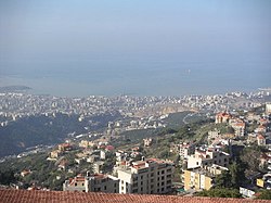
Beit Mery
بيت مري | |
|---|---|
City | |
 View over the hill | |
| Coordinates: 33°51′56″N 35°35′43″E / 33.8656°N 35.5953°E | |
| Country | |
| Governorate | Mount Lebanon Governorate |
| District | Matn District |
| Elevation | 800 m (2,600 ft) |
| Time zone | UTC+2 (EET) |
| • Summer (DST) | UTC+3 (EEST) |
| Dialing code | +961-4- |
Beit Mery (Arabic: بيت مري ; also Beit Mer, Beir Meri) is a Lebanese town overlooking the capital Beirut. The town has been a summer mountain resort since the times of the Phoenicians and later the Romans.
The name derives from Aramaic and means "The house of my Lord". On one of the three hills of Beit Mery (Southern end of town) along the Lebanon Western mountain range are the ruins of the old Phoenician and Roman temples that were erected in the same general area in what is now known as Deir El-Qala'a (دير القلعة).
At present, a Christian church and monastery sit on top of parts of the old Roman temple. Les Scouts Du Liban Groupe Sainte Marie Beit Mery is one of the biggest movement in town and it is located in College des Freres since 1969. Beit Mery is home to a Lebanese Red Cross First Aid Center.[1]
- ^ Our Centers Archived February 12, 2006, at the Wayback Machine
