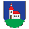
Bela Crkva
| |
|---|---|
Town and municipality | |
Bela Crkva | |
 Location of Bela Crkva within Serbia | |
| Coordinates: 44°53′51″N 21°25′01″E / 44.89750°N 21.41694°E | |
| Country | |
| Province | |
| District | South Banat |
| Government | |
| • Mayor | Tatjana Kokar (SNS) |
| Area | |
| • Town | 38.82 km2 (14.99 sq mi) |
| • Municipality | 353.34 km2 (136.43 sq mi) |
| Elevation | 78 m (256 ft) |
| Population (2022 census)[1] | |
| • Town | 7,456 |
| • Town density | 190/km2 (500/sq mi) |
| • Municipality | 14,451 |
| • Municipality density | 41/km2 (110/sq mi) |
| Time zone | UTC+1 (CET) |
| • Summer (DST) | UTC+2 (CEST) |
| Postal code | 26340 |
| Area code | +381(0)13 |
| Car plates | VŠ |
| Website | www.belacrkva.rs |
 | |

Bela Crkva (Serbian Cyrillic: Бела Црква, pronounced [bɛ̂ːlaː tsr̩̂ːkv̞a]; German: Weißkirchen; Hungarian: Fehértemplom; Romanian: Biserica Albă) is a town and municipality located in the South Banat District of the autonomous province of Vojvodina, Serbia. The town has a population of 7,456, while the Bela Crkva municipality has 14,451 inhabitants (2022 census).
Bela Crkva lakes at the outskirts of the town are a popular summer tourist destination.
- ^ "Census 2022: Total population, by municipalities and cities". popis2022.stat.gov.rs.


