| Belconnen Australian Capital Territory | |||||||||||||||
|---|---|---|---|---|---|---|---|---|---|---|---|---|---|---|---|
 Tablet at Aranda playing fields marks the beginning of the development of Belconnen in 1966. | |||||||||||||||
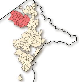
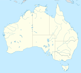
 Location of Belconnen in the Australian Capital Territory | |||||||||||||||
 | |||||||||||||||
| Coordinates | 35°14′19″S 149°03′58″E / 35.2386°S 149.0661°E | ||||||||||||||
| Population | 106,061 (2021 census)[1] | ||||||||||||||
| • Density | 1,377/km2 (3,567/sq mi) | ||||||||||||||
| Gazetted | 12 May 1966[2] | ||||||||||||||
| Postcode(s) | 2614-2617 | ||||||||||||||
| Area | 77 km2 (29.7 sq mi)[3] | ||||||||||||||
| Location | 7 km (4 mi) NW of Canberra | ||||||||||||||
| Territory electorate(s) | |||||||||||||||
| Federal division(s) | |||||||||||||||
| |||||||||||||||
Belconnen (/ˈbɛlkɒnɪn/) is a district in the Australian Capital Territory in Australia. The district is subdivided into 27 divisions (suburbs), sections and blocks. As at the 2021 census, the district had a population of 106,061 people;[1] and was the most populous district within the Australian Capital Territory (ACT).
Belconnen is situated approximately 7 kilometres (4.3 mi) to the north-west of the central business district of Canberra, and surrounds an artificially created, ornamental lake, Lake Ginninderra. Lake Ginninderra was made possible by building a dam at an elbow of Ginninderra Creek. Exiting the lake, via a simple overflow, Ginninderra Creek continues, and runs north-west to its confluence with the Murrumbidgee River just beyond the north-western ACT border.
- ^ a b Australian Bureau of Statistics (28 June 2022). "Belconnen (SA3)". 2021 Census QuickStats. Retrieved 11 September 2022.
- ^ "Districts Ordinance 1966 No. 5 (ACT)" (PDF).
- ^ "3218.0 – Regional Population Growth, Australia, 2012". Australian Bureau of Statistics. Retrieved 21 June 2012.
