| Ben Rinnes | |
|---|---|
| Beinn Ruaidhneis | |
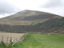
 View of Ben Rinnes from the south-east | |
| Highest point | |
| Elevation | 841 m (2,759 ft) |
| Prominence | 512 m (1,680 ft) |
| Listing | Corbett, Marilyn |
| Coordinates | 57°24′12″N 3°14′29″W / 57.40328°N 3.2415°W |
| Naming | |
| English translation | Promontory hill |
| Language of name | Gaelic |
| Pronunciation | Scottish Gaelic: [peɲ ˈɾɤiɲɛʃ] |
| Geography | |
| Parent range | Grampian Mountains |
| OS grid | NJ255354 |
| Topo map | Ordnance Survey Landranger 28 |
Ben Rinnes (Scottish Gaelic: Beinn Ruaidhneis) is a mountain in Banffshire, in northern Scotland.[1][2] The mountain is popular with hikers. The mountain is 20 km2 in total and is located 8 km southwest of Dufftown. The mountain has one main path and can be easily accessed from the nearby car park. The Friends of Ben Rinnes program has been working on the paths to make it more accessible to the public and to prevent further erosion of the fragile ecosystem on the steep slopes and has been rather successful.
- ^ Aberlour, 2008
- ^ "About Ben Rinnes". Friends of Ben Rinnes. Retrieved 18 June 2018.
