| Berala Sydney, New South Wales | |||||||||||||||
|---|---|---|---|---|---|---|---|---|---|---|---|---|---|---|---|
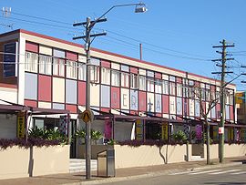
 Berala Hotel, Woodburn Road | |||||||||||||||
 | |||||||||||||||
| Population | 8,757 (2021 census)[1] | ||||||||||||||
| Postcode(s) | 2141 | ||||||||||||||
| Elevation | 28 m (92 ft) | ||||||||||||||
| Location | 16 km (10 mi) west of Sydney CBD | ||||||||||||||
| LGA(s) | Cumberland Council | ||||||||||||||
| State electorate(s) | Auburn | ||||||||||||||
| Federal division(s) | |||||||||||||||
| |||||||||||||||
Berala is an inner suburb of Sydney, which connects the inner west, south west and western parts of Sydney in the state of New South Wales, Australia, located only 16 kilometres west of the central business district, in the local government area of Cumberland Council. Postcode: 2141, sharing it with Lidcombe.
- ^ Australian Bureau of Statistics (28 June 2022). "Berala (State Suburb)". 2021 Census QuickStats. Retrieved 4 August 2024.