| Bernal Heights Summit | |
|---|---|
 Bernal Heights hill viewed from the north | |
| Highest point | |
| Elevation | 475+ feet (145+ m) NGVD 29[1] |
| Coordinates | 37°44′35″N 122°24′57″W / 37.7429861°N 122.4158042°W[2] |
| Geography | |
| Location | San Francisco California, U.S. |
| Topo map | USGS San Francisco South |
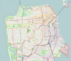
Bernal Heights Summit (/ˈbɜːrnəl/ BUR-nəl) or Bernal Heights Hill is a hill in the San Francisco, California neighborhood of Bernal Heights. Upper elevations are part of Bernal Heights Park, which the San Francisco Recreation & Parks Department manages. At its highest elevation (466 ft.) is a privately owned equipment building and 50-foot tall telecommunications tower.[3] The tower does not have an official name, but some residents call it "Sutrito", as it resembles a shorter version of Sutro Tower.[4] The park and summit are largely surrounded by Bernal Heights Boulevard.

- ^ San Francisco South quadrangle, California (Map). 1:24000. 7.5 Minute Topographic. USGS.
- ^ "Bernal Heights". Geographic Names Information System. United States Geological Survey, United States Department of the Interior. Retrieved 2009-06-12.
- ^ "Conditional Use Authorization" (PDF). San Francisco Planning Department. Archived from the original (PDF) on 2011-08-27. Retrieved 2011-08-21.
- ^ "Nomenclature Update: Introducing 'Sutrito Tower'". Bernalwood. 22 September 2011.
