Bethanie
ǀUiǂgandes Klipfontein | |
|---|---|
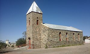
 The Lentia Lutheran Church, built 1899. The village's mission church is in the background on the left. | |
| Coordinates: 26°30′00″S 17°09′30″E / 26.50000°S 17.15833°E | |
| Country | |
| Region | ǁKaras Region |
| Constituency | Berseba Constituency |
| Population (2012) | |
| • Total | 2,000 |
| Time zone | UTC+2 (SAST) |
| Climate | BWh |


Bethanie (often in German: Bethanien, and in English: Bethany, previously Klipfontein, Khoekhoegowab: ǀUiǂgandes[1]) is a village in the ǁKaras Region of southern Namibia. It is one of the oldest settlements in the country. Bethanie is situated on the C14 road between Goageb and Walvis Bay, 100 km west of Keetmanshoop. It has a population of about 2,000.[2]
- ^ Vedder 1997, p. 198.
- ^ Tonchi, Lindeke & Grotpeter 2012, p. 40.
