Bhimdatta Municipality
(भीमदत्त नगरपालिका) Mahendranagar (महेन्द्रनगर) | |
|---|---|
 | |
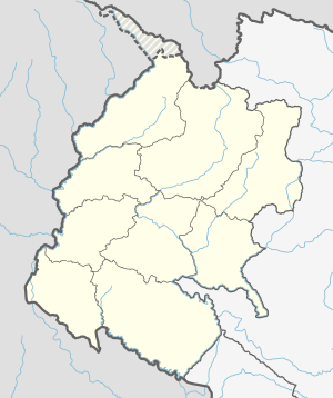
 Bhimdatta municipality in Kanchanpur District | |
| Coordinates: 28°55′N 80°20′E / 28.917°N 80.333°E | |
| Country | Nepal |
| Province | Sudurpashchim |
| District | Kanchanpur |
| Government | |
| • Mayor | padam bogati |
| • Deputy Mayor | nilam lekhak |
| Area | |
| • Total | 171.24 km2 (66.12 sq mi) |
| Elevation | 229 m (751 ft) |
| Population (2021) | |
| • Total | 122,320 |
| • Density | 710/km2 (1,900/sq mi) |
| Time zone | UTC+5:45 (NST) |
| Post code | 10400 |
| Area code | 10406 |
| Literacy Rate | 77% (age 5+) |
| Website | bheemdattamun |
Mahendranagar (Nepali: महेन्द्रनगर), officially known as Bhimdattanagar (Nepali: भिमदत्त), is a municipality in Kanchanpur District of Sudurpashchim Province, Nepal. The city and the municipality were named Mahendranagar in honour of the late King Mahendra of Nepal. After becoming a republic in 2008, the Mahendranagar municipality name was changed to Bhimdatta municipality in honour of the revolutionary farmer leader Bhimdatta Panta.[3] It is surrounded by Bedkot Municipality in the east, Dadeldhura District in the north, Shuklaphanta National Park in the south and Uttarakhand, India in the west.
Mahendranagar is the 9th largest city in Nepal. It is 5 kilometres (3.1 mi) east of the Indian border and 700 kilometres (430 mi) west of Kathmandu. At the time of the 1991 Nepal census, it had a population of 62,050.[4] According to the census of 2001, the city's population was 80,839. Bhimdatta is a hub of activity for industries running between India and Nepal. It is also a gateway to Shuklaphanta National Park, formerly Shuklaphanta Wildlife Reserve.
- ^ "Archived copy". Archived from the original on 2018-03-15. Retrieved 2021-05-17.
{{cite web}}: CS1 maint: archived copy as title (link) - ^ "Bhimdatta Nepal on the Elevation Map. Topographic Map of Bhimdatta Nepal". elevationmap.net. Archived from the original on 2021-05-10. Retrieved 2019-08-16.
- ^ "हाम्रो बारेमा | भीमदत्त नगरपालिका". Bhimdattaamun.gov.np (in Nepali).[permanent dead link]
- ^ "Nepal Census 2001". Nepal's Village Development Committees. Digital Himalaya. Archived from the original on October 12, 2008. Retrieved November 24, 2008.

