| Biamanga National Park New South Wales | |
|---|---|
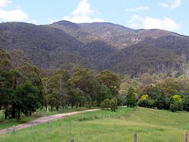
 Mumbulla Mountain from the Princes Highway, Australia | |
| Nearest town or city | Bega |
| Coordinates | 36°27′04″S 149°56′31″E / 36.45111°S 149.94194°E |
| Established | 1994 |
| Area | 137.49 km2 (53.1 sq mi)[1] |
| Managing authorities | NSW National Parks and Wildlife Service |
| Website | Biamanga National Park |
| See also | Protected areas of New South Wales |
Biamanga National Park is a protected area in New South Wales, Australia,[1] 408 km (254 mi) south of Sydney and 40 km (25 mi) north of Bega. The park forms part of the Ulladulla to Merimbula Important Bird Area because of its importance for swift parrots.
Its name derives from Yuin elder Biamanga, aka "King Jack Mumbulla", after whom Mumbulla Mountain was also named. It is an important Aboriginal site for the Yuin people and a prominent landmark that can be seen from across the Bega Valley, also known as Biamanga. Proclaimed in 1994 and extended in 1997, the park covers 13,617 ha (33,650 acres). It is seen by the traditional owners as "part of a single cultural landscape" with the Gulaga National Park, and also has cultural links to Umbarra (Merriman Island), Barunguba (Montague Island), and Dithol (Pigeon House Mountain).
In November 2021 Mumballa Mountain was ascribed the dual name of Biamanga.
- ^ a b Department of Environment Climate Change and Water Annual Report 2009-10 (Report). Department of Environment Climate Change and Water. November 2010. pp. 274–275. ISSN 1838-5958.
